


RICHMOND, Va. — Richmond’s Department of Public Works is urging patience as crews work to clear city streets following a winter storm that brought snow, ice, black ice, and record‑low temperatures.
"It’s going be a somewhat longer recovery than we’ve had in the past,” said Torrence Robinson, the city’s deputy director of operations and maintenance.
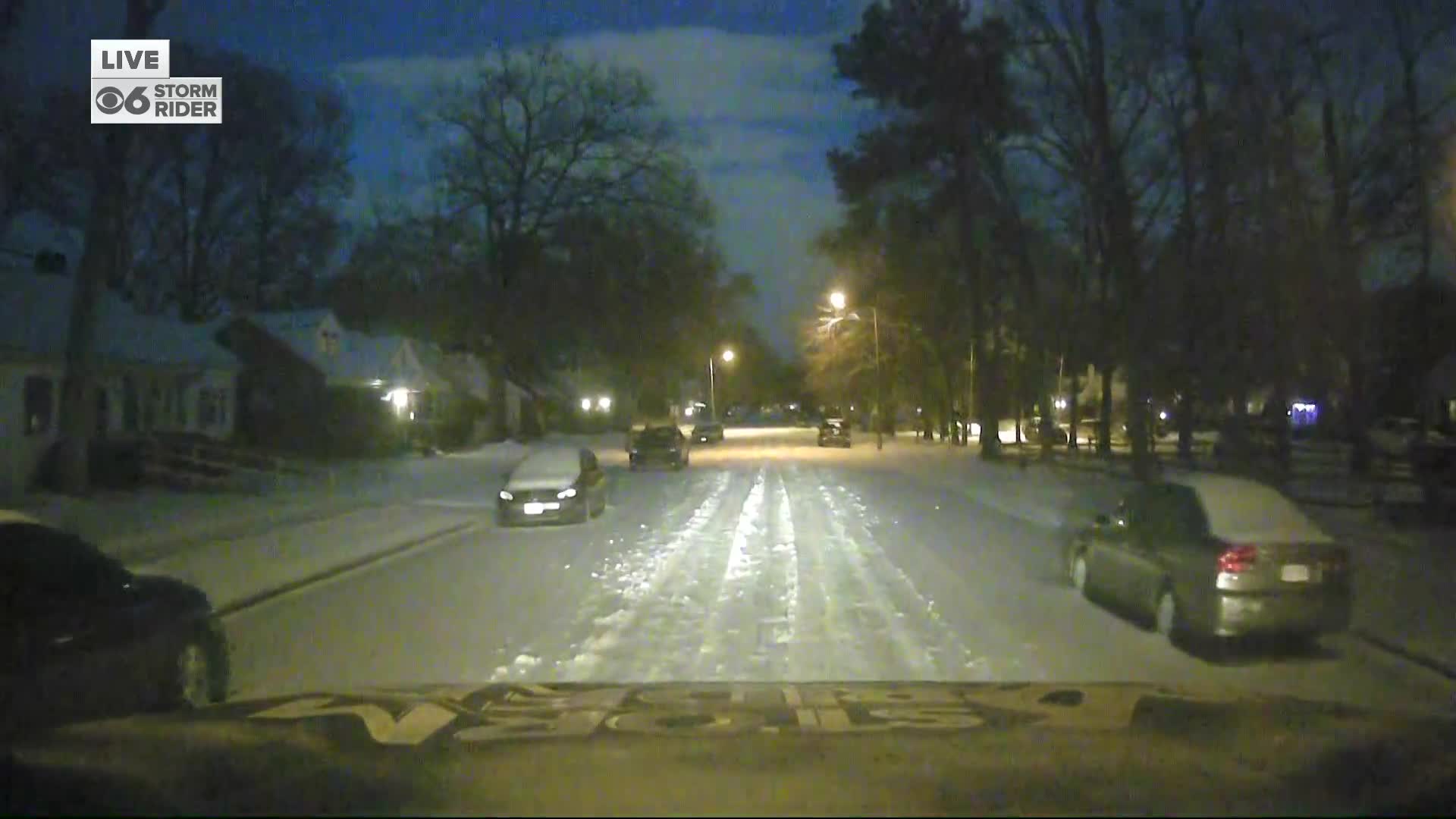
Take a look at some of Richmond's residential streets around 6 p.m. Monday in the video player below.
Who is responsible for clearing roads in my area?
In Richmond, VDOT is responsible for plowing roads maintained by the state, like the interstates.
City crews are responsible for most other streets, including Broad Street.
In Henrico, VDOT is responsible for maintaining Broad Street, while the county takes care of all secondary roads and residential streets.
In both Chesterfield and Hanover, VDOT is responsible for plowing all public roads, though developers and subdivisions can contract for private snow removal.
Clearing Richmond neighborhoods
Robinson said the city has about 240 employees, using 75 trucks to treat and plow roughly 1,800 lane miles of roadway, with crews working in 12‑hour shifts day and night.
The work began two days before the storm hit with pre‑treatment, then moved into plowing primary and secondary roads, and now includes addressing neighborhoods.
However, the extreme cold has limited the effectiveness of sand and salt applications, which “need temperatures above 20 degrees in order for them to be effective.”
Finishing primary and secondary routes remains the priority, but crews anticipate “getting into the neighborhoods tomorrow night” and working there through early Thursday.

Robinson asked Richmonders to stay home if possible and to help plows by parking in driveways or, if street parking is necessary, on the same side of the road.
“Don’t come out unless you have to,” he said.
The combination of snow, ice, and now black ice has forced the department to “attack this storm in three different ways,” placing a major strain on resources, he added.
"Just be patient, know that we’re out working, and we’ll continue to make the roads safe as quickly as possible," he said.
The City of Richmond said once the roads deemed Priority 1 and Priority 2 roads are clear, they can move into residential neighborhoods.

Local News
How to track VDOT snow plows
Priority 1 and Priority 2 Snow Routes by Geographic Area
NORTHSIDE
Route 6 – Scott’s Addition / Ginter Park
P1: North Boulevard/Hermitage Rd. – Robin Hood Rd. to CL; Laburnum – RMA to CL
P2: Hillmonument Pkwy. – Hermitage to Imperial Plaza; Corbin/Cheatwood/Moss Side – North to North; Bellevue – Hermitage to Brook; Fauquier/Newport – Bellevue to Laburnum
Route 7 – Boulevard Bridge North Approach / Byrd Park North Access
P1: Robin Hood Rd. – Boulevard to Brookland Pkwy.; N. Boulevard – Robin Hood to Boulevard Bridge; Expressway bridges
P2: Douglasdale – N. Boulevard to McCloy (Rt. 161); Pumphouse – to dead end; Rugby – to dead end
Route 8 & 8A – Azalea Ave. / Brook Rd. Corridor
P1: Azalea Ave. – Brook Rd. to ECL; Brook Rd. – CL to Chamberlayne Pkwy.; Brookland Park Blvd. – Hermitage to Rady
P2: Fendall – Brookland Park Blvd. to North Ave.
Route 9 – Meadowbridge / Hospital St. Corridor
P1: Meadowbridge Rd. – CL to Brookland Park Blvd.; 2nd, 3rd, 4th & 5th Sts. – Hospital St. to Jackson St.
P2: Richmond-Henrico Trpk. – Brookland Park Blvd. to Valley Rd.; Valley Rd./2nd St./Hospital St./St. James – loop
Route 10 – Highland Park
P1: Dill Rd. – CL to 2nd Ave.; Utah/Pollock – Dill to Dill; Magnolia – 2nd Ave. to Mechanicsville; Rady St. – Dill to Magnolia
P2: Dove St. – North Ave. to Willow St.
SOUTHSIDE
Route 30 – Westover Hills / Boulevard Bridge South
P1: Midlothian & Belt Blvd. – ramps; Boulevard Bridge; New Kent – 42nd St. to Dorchester; West 42nd St. – Riverside to Forest Hill; Riverside – 42nd to Lee Bridge
P2: Riverside/Pineway – 42nd to Forest Hill; 41st/Dunston – Forest Hill to Roanoke
Route 31 – Commerce Rd. / Port Area
P1: Commerce Rd. – Bainbridge to Walmsley
P2: Deepwater Terminal Rd. – upper bridge to port; Commerce Rd. – Walmsley to SCL; Ruffin Rd. – Jeff Davis Hwy. to Commerce
Route 32 – Bells Rd. / Bellemeade
P1: Bells Rd./Belt Blvd. – Commerce to Broad Rock; Bellemeade – Commerce to Jeff Davis Hwy.
P2: Terminal Ave. – Jeff Davis Hwy. to Belt Blvd.
Route 33 – Cherokee / Huguenot / Riverside Sector
P1: Cherokee – Forest Hill to Huguenot; Old Westham/Hathaway – Hathaway to Cherokee
P2: Cherokee – Huguenot to WCL; Riverside/Scottview/Longview – Hathaway to Hickory; Hickory – Riverside to Cherokee; Hathaway – Forest Hill to Longview; Rockfalls – Riverside to Riverside
Route 34 – Forest Hill Corridor
P1: Forest Hill – Powhite to WCL; Jahnke Rd. – Forest Hill to WCL
P2: Boroughbridge/Covington – Jahnke to Midlothian
Route 35 – Walmsley / Ironbridge
P1: Walmsley Blvd. – CL to Jeff Davis Hwy.; Belmont Rd. – CL to Walmsley Blvd.; Ironbridge – CL to Walmsley
P2: Old Belmont/Orcutt La./Bryce La./Hey Rd. – Broad Rock to Hull St.; Brookbury – Ironbridge to Bathgate
Route 36 – Broad Rock / Forest Hill / Bainbridge
P1: Broad Rock – Belt Blvd. to Forest Hill Ave.; Forest Hill – Broad Rock to Roanoke; Roanoke St. – Midlothian Trpk. to Forest Hill Ave.; Bainbridge – Broad Rock to 7th St.; 7th St. – Hull St. to Semmes Ave.
P2: Crutchfield – Roanoke to Belt Blvd.
Route 37 – Elkhardt / Jahnke / Forest Hill South Connectors
P1: Elkhardt/Whitehead/German School Rd. – Hull St. to Jahnke Rd.; Blakemore/Bliley – Jahnke to Forest Hill
Route 37A – Jahnke to Bells Connectors
P1: Hioaks/Carnation/Warwick – Jahnke to Bells
Route 38 – Hopkins / Maury
P1: Hopkins Rd. – CL to Jeff Davis Hwy.
P2: Cofer Rd. – Jefferson Davis Hwy. to Hopkins Rd.; Maury St. – Commerce to Holly Springs Rd.; Holly Springs – Hopkins to Maury; 26th St./Clopton – Semmes to Maury
Route 39 – Huguenot Corridor
P1: Huguenot Rd. – Powerline to Riverside Dr.
P2: Chippenham Rd.; Sherbrook; Old Spring; Waxford
Route 40 – Hopkins Rd. Bridge
P1: Hopkins Rd. Bridge – Main St. to Bainbridge
Route 43 – Chippenham Corridor
P1: Chippenham Pkwy – Huguenot Rd. to Forest Hill Ave.
P2: Custis/Stratford – Riverside to Forest Hill
Route 43A & 43B – Chippenham Parkway / James River Bridge
P1: Chippenham – Huguenot Rd. to James River Bridge
P2: Stony Point Pkwy. & ramps
Route 44 – Stony Point Area
P1: Stony Point/Evansway/Cedar Grove/Croatan – Huguenot Rd. to Cherokee; Westgate – Huguenot to Evansway
P2: Oldfield; Duryea; Old Gun; Garfield; Traylor
Route 45 – Forest Hill / Semmes Corridor
P1: Forest Hill Ave. – Semmes Ave. to Powhite Pkwy.; Semmes Ave. – 7th St. to Forest Hill Ave.
Route 46 – Jefferson Davis Hwy. / Cowardin Corridor
P1: Jefferson Davis Hwy./Cowardin – CL to Semmes Ave.
Route 47 – Midlothian Corridor
P1: Midlothian Trpk. – Chippenham Pkwy. to Hull St.
Route 48 – Hull / Maury / Broad Rock South
P1: Hull St. – Dock St. to Chippenham Pkwy.; 4th St. – Hull to Maury; 2nd St. – Maury to Hull; Maury St. – Commerce Rd. to 2nd St.
Route 49 – Broad Rock / Westover Hills Blvd.
P1: Broad Rock – Belt Blvd. to Walmsley Blvd.; Belt/Westover Hills Blvd. – Broad Rock to Evelyn Byrd
DOWNTOWN / FAN / MUSEUM DISTRICT
Route 1 – Cary/Main/Thompson
P1: Cary St. – WCL to Belvidere St.; Main St. (Elwood) – Belvidere St. to Thompson St.; Thompson St. – Elwood to Cary St.
Route 2 – Grove/Three Chopt/Linden
P1: Grove Ave.; Three Chopt Rd.; Linden St.
P2: Towana/Campus; Boatwright
Route 3 – Patterson/Kensington/Libbie
P1: Patterson Ave.; Kensington Ave.; Libbie Ave.
P2: Maple Ave.
Route 4 – Monument/Lombardy
P1: Monument Ave.; Lombardy – Monument to Chamberlayne Ave.
P2: Westmoreland; Commonwealth; Lombardy St.; Robinson/Hanover
Route 5 & 5A – Broad/Staples Mill/Grace
P1: Broad St. – 12th St. west to CL; Staples Mill Rd.; Grace St. – Boulevard to Belvidere St.
P2: Hanover/Marshall/Goshen – Broad to Broad
Route 16 – MLK Bridge / Leigh Corridor
P1: Martin Luther King Bridge – 19th St. to Mosby St.; Leigh St. – Boulevard to King Bridge; Hermitage/Meadow – Westwood to Idlewood Ave.
P2: Bowe St. – Moore St. to Broad St.
Route 17 – Lee Bridge / Cherry Bridge Corridor
P1: Lee Bridge – Cary St. to Semmes Ave.; Cherry St. bridge & Laurel St. Bridge
P2: Laurel St.; Harrison/Colorado/Meadow/Grayland/Allen – loop
Route 18 – Franklin/Grace/College Corridor
P1: Franklin/Grace; Marshall/College; Jackson/Clay – Belvidere St. to 8th
Route 19 – Adams/Leigh Corridor
P1: Adams St. to 12th St. – Broad St. to Leigh St. (inclusive)
P2: Jefferson/Madison/Monroe/Henry/Adams – Leigh St. to Canal St.
Route 20 – Saunders/Westwood/Malvern Corridor
P1: Saunders/Westwood/Malvern – Laburnum to Cary St.; Hamilton – Westwood to Cary St.; Thompson St. – Cary to Broad St.
Route 41 – Downtown Bridge Access Roads
P1: 4th–14th Sts. – Broad St. to Canal St. or Byrd St.
P2: Tredgar St.; 6th St. – Grace St. to Canal St.
Route 42 – Main/Cary/Canal Corridor
P1: Main St./Cary St./Canal St./Byrd St./12th St./Bank – Belvidere St. to 14th; Cumberland/Idlewood – Belvidere to Harrison St.
Route 50 & 50A – Chamberlayne / Westwood Sector
P1: Chamberlayne Ave., Belvidere St. – NCL to Lee Bridge; Westwood Ave. – Chamberlayne to Acca Bridge
P2: Westbrook; North/Poe/Monterior/1st – Chamberlayne to Duval; Crestwood – Westwood to Bellview
EAST END
Route 11 – Mosby / Fairfield Corridor
P1: Mosby/Mechanicsville Trpk. – Jefferson to ECL; Fairmount Ave.; Cool Lane – Mechanicsville to nursing home; Fairfield – Mechanicsville to 17th St.
P2: Fairfield Ave. – CL to Mechanicsville; Whitcomb/Mechanicsville/Bowling Green – loop
Route 12 – Nine Mile / 25th St. Corridor
P1: Nine Mile Rd./25th St. – Broad St. to CL; 17th, 18th, & 21st Sts. – Broad St. to Hospital St.
Route 13 – Government / Darbytown Corridor
P1: Government Rd. – Chimborazo Blvd. to Williamsburg Rd.; Accomac/Jennie Scher/Parker/Darbytown Rd. – loop
P2: Admiral Gravely Blvd. – Government Rd. to Williamsburg Rd.; Crestview – 38th St. to Government Rd.; Jennie Scher Rd. – Government Rd. to E. Richmond Rd.
Route 14 – Church Hill / East End Core
P1: Broad St. – 12th St. to Chimborazo Blvd.; Marshall St. – 25th St. to 21st St.
P2: Venable St.; Chimborazo Blvd.; Stony Run; M St./23rd St./Tulip/22nd St. – Broad St. to Fairfield Ave.
Route 15 – Williamsburg Rd. / Main / Hatcher Corridor
P1: Williamsburg Rd. – Government Rd. to CL; Main St. – CL to 14th St.; Hatcher/Newton – loop
Always Treated Ambulance Station Locations
Hermitage Rd. at Overbrook Rd.
Maury St. at Clopton St.
25th St. between R and Q
Parkwood Ave. at Shields Ave.
Forest Hill Ave. at CSX overpass
Chantilly St. south of Broad St.
This is a developing story. Email the CBS 6 Newsroom if you have additional information to share.
📲: CONNECT WITH US
Blue Sky | Facebook | Instagram | X | Threads | TikTok | YouTube

This story was initially reported by a journalist and has been converted to this platform with the assistance of AI. Our editorial team verifies all reporting on all platforms for fairness and accuracy. To learn more about how we use AI in our newsroom, click here.

