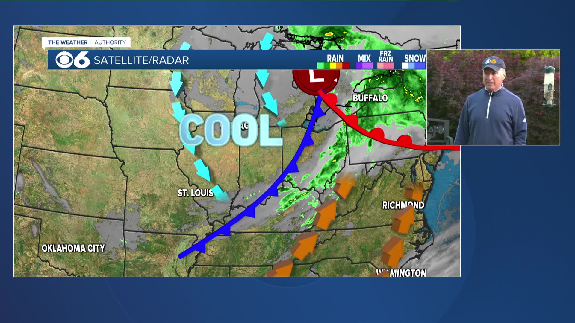
UPDATED 8:47AM FRIDAY: The new Slight Risk maps for Virginia and our region are larger, covering nearly all of Virginia and the Mid-Atlantic. Threats remain the same: damaging wind gusts (60mph+) and isolated tornadoes.


UPDATED 6AM FRIDAY: An intensifying line of storms will cross the Blue Ridge early this afternoon, and potentially produce severe wind gusts and isolated tornadoes this afternoon and evening as the line advances east through central Virginia ahead of an approaching cold front. If you have outdoor plans late afternoon and evening in central Virginia, you need to be weather aware and have an indoor, safe back-up plan!

By this afternoon, winds will be sustained at 15 to 25 mph with higher gusts as the cold front is crossing into western Virginia. High temperatures this afternoon will also be warm into the low 80s. All of these factors, from the winds to the moisture and peak heating will allow the approaching line of storms to intensify as it crosses the Blue Ridge into central Virginia.Strong to severe storms are expected to initially reach I-95 generally between 5 and 6 p.m. These storms will be capable of producing damaging wind gusts, marginally severe hail, and brief tornadoes. The most likely area for tornadoes should be close to the Virginia-North Carolina state line where there will be the greatest juxtaposition of heat, moisture, and low-level wind shear.
UPDATED 2 PM THURSDAY: The Storm Prediction Center has placed much of our viewing area in a slight risk for severe weather.
PREVIOUS POST, 8 PM WEDNESDAY:
A powerful storm system will continue moving across the country through the end of the week. It will affect us late Friday with the potential for severe weather.
A strong cold front will pass across the state late Friday afternoon through Friday evening. Ahead of the front, it will be warm (highs in the 80s) and a bit humid (dew points in the 60s). Behind the front, temperatures will be in the 40s, 50s & 60s.
It looks like a squall line of strong to severe thunderstorms will be possible towards the end of Friday, first affecting western Virginia in the mid to late afternoon, and then central & eastern Virginia during the evening. The storms should exit to the east overnight, although some heavy rainfall will still be located behind the cold front. Our area will dry out after daybreak on Saturday.
As of now, the main threats appear to be strong winds with the potential for some large hail and heavy rainfall. However, the dynamics with this storm suggest an isolated tornado cannot be ruled out.
We will continue to monitor this and keep you updated over the next 48 hours.
Stay With CBS 6, We’ll Keep You Ahead of the Storm


